
Seawall and shoreline planning in Wabasso Beach
A Wabasso Beach address can put the project near very different waterfronts. Describe whether the wall faces the lagoon, an interior waterway or the Atlantic before comparing methods, prices or permit advice.
Describe your project on this page ↓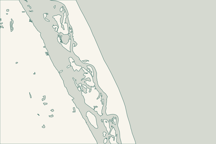
Get to know your waterfront
Wabasso Beach is the barrier-island community, separate from mainland Wabasso. The county’s Wabasso Beach Park sits on the Atlantic at 1820 Wabasso Beach Road; Wabasso Causeway Park is a different facility on the lagoon crossing. These landmarks help orient a project, but they do not establish a private lot’s access or ownership.
Wabasso Beach Park · TIGERweb Places, County Subdivisions, Consolidated Cities and Subminor Civil Divisions
Match the assessment to the correct shoreline
For an existing lagoon wall, ask the assessor to record alignment, panel joints, cap condition and the ground behind it. For an Atlantic-facing project, locate the beach-and-dune regulatory line and recover prior coastal permits before treating the work as an ordinary canal-wall repair. Apply for a Coastal Construction Control Line permit CCCL Publications
Protected habitats are part of the north-island setting. Pelican Island refuge public access follows Historic Jungle Trail, about 3.7 miles north of CR 510. Its visitor map distinguishes lagoon islands from the ocean shore. The federal agency also describes the Archie Carr refuge corridor extending south to Wabasso Beach. None of these regional references proves the boundary of your property. Visit Us — Pelican Island National Wildlife Refuge Pelican Island National Wildlife Refuge visitor brochure and map
The county’s Wabasso Beach camera is live, not recorded. Save dated photographs of your own property when it is safe; the feed cannot later provide a historical storm record. Wabasso Beach live camera
For an unincorporated parcel, the county Building Division is 772-226-1260. Confirm jurisdiction first if the address is near Orchid or Indian River Shores. Building jurisdiction and contact
What could the work cost?
Ask whether the estimate assumes land access, marine access or removal of part of an existing dock. Those are different construction approaches. Vegetation protection, temporary access and reinstating the yard should appear alongside the wall work, with assumptions stated before a deposit.
Published planning ranges help you start a budget. Your property’s final price depends on the scope and site conditions.
Compare quotes and plan a budget →Find the relevant permits and records
| Starting point | What to resolve | Prepare and look up |
|---|---|---|
Indian River County Building Division | Local building review for an unincorporated parcel. | Confirmed jurisdiction, survey, engineered drawings and any separate dock scope. |
DEP Central District | Water-resource review for lagoon-facing work. | Existing wall location, proposed footprint and aquatic vegetation details. |
DEP coastal construction program | Oceanfront work within applicable beach-and-dune jurisdiction. | Coastal-line map, earlier authorizations and proposed excavation limits. |
Before requesting a Wabasso Beach proposal
Make the location and access assumptions visible to every bidder.
Mark the water-facing side
Label the lagoon or Atlantic on your survey and identify the nearest road access. Include adjoining structures in the photographs.
Check habitat boundaries
Use official property and environmental mapping. A refuge brochure helps with orientation but cannot replace a boundary survey.
Pelican Island National Wildlife Refuge visitor brochure and map · County GIS resources
Document the condition yourself
Keep dates with wall and yard photographs; the public beach camera does not retain recordings.
Describe the waterfront you need help with
Share the side of the island, visible wall changes, vegetation near the work and how the property can be accessed.
Clear guidance for your waterfront project.
Wabasso Beach project questions
Is Wabasso Beach the same as mainland Wabasso?
No. Census identifies them separately on opposite sides of the lagoon. Use the full address and parcel details when requesting permit guidance.
TIGERweb Places, County Subdivisions, Consolidated Cities and Subminor Civil Divisions
Can nearby public beach access be used for equipment?
Public recreation access does not establish permission for construction staging. Require the contractor to identify the proposed route and any needed authorization.
Does a refuge nearby mean my lot is inside it?
No. Establish the actual boundaries and relevant habitat conditions. A regional visitor map does not make a parcel-specific determination.
Pelican Island National Wildlife Refuge visitor brochure and map
Keep planning
Nearby waterfront guides
Show sourcesHide sources
- Wabasso Beach ParkSource reviewed 2026-10-26
- TIGERweb Places, County Subdivisions, Consolidated Cities and Subminor Civil DivisionsSource reviewed 2026-10-26
- Apply for a Coastal Construction Control Line permitSource reviewed 2026-10-26 · official indexed text
- CCCL PublicationsSource reviewed 2026-10-26
- Visit Us — Pelican Island National Wildlife RefugeSource reviewed 2026-10-26
- Pelican Island National Wildlife Refuge visitor brochure and mapSource reviewed 2026-10-26
- Wabasso Beach live cameraSource reviewed 2026-10-26
- Building jurisdiction and contactSource reviewed 2026-10-26
- Survey and structural drawingsSource reviewed 2026-10-26
- DEP Central District contactSource reviewed 2026-10-26
- Mangrove Frequently Asked QuestionsSource reviewed 2026-10-26 · official indexed text
- County GIS resourcesSource reviewed 2026-10-26