
Seawall and riverbank repair in Roseland
A Roseland riverfront project starts with the bank, the existing structure and the water arriving from inland. Before adding fill or replacing a wall, establish whether swales, road culverts or other drainage features interact with the proposed work.
Describe your project on this page ↓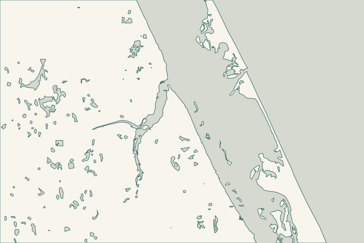
Get to know your waterfront
Roseland is separate from the City of Sebastian. County riverfront landmarks include Roseland Community Park’s boardwalk and Dale Wimbrow Park on Roseland Road. Farther along the river system, the county’s Sebastian Canoe Launch sits on the South Prong. Use the actual river reach when describing your property.
Roseland Community Park · Dale Wimbrow Park · Sebastian Canoe Launch · TIGERweb Places, County Subdivisions, Consolidated Cities and Subminor Civil Divisions
Trace drainage from the road to the river
The county stormwater plan describes Roseland runoff passing through swales and culverts beneath Roseland Road toward the South Prong. That historical description is a useful starting question, not proof of the current capacity or condition of a drainage feature beside your lot. Comprehensive Plan — Stormwater Management Sub-Element
The plan also describes several drainage jurisdictions along the South Prong. The agency maintaining a culvert or channel may differ from the office reviewing your wall. Identify the feature before asking who can approve changes to it. Comprehensive Plan — Stormwater Management Sub-Element
Have the assessor distinguish bank erosion, soil escaping behind a structure and damage within the wall itself. Record the location of vegetation, outfalls and neighboring structures. A proposal to place fill should explain its purpose, limits and drainage consequences.
The Historic Roseland Neighborhood Plan study area extends beyond the Census community boundary near Roseland Road. Use it for planning context; use parcel mapping and the survey for ownership and jurisdiction. Historic Roseland Neighborhood Plan
County Building serves unincorporated properties at 772-226-1260. For federal regulatory questions, the Army Corps Cocoa section lists 321-504-3771. Building jurisdiction and contact Jacksonville District Regulatory Office Locations
What could the work cost?
Separate bank investigation, structural repair, drainage coordination and access in the estimate. A quote that assumes fill alone will solve the problem should explain the diagnosis first. Include restoration of any disturbed slope or planting and clarify who handles approvals involving separate drainage facilities.
Published planning ranges help you start a budget. Your property’s final price depends on the scope and site conditions.
Compare quotes and plan a budget →Find the relevant permits and records
| Starting point | What to resolve | Prepare and look up |
|---|---|---|
Indian River County Building Division | Local building review for an unincorporated Roseland parcel. | Address, survey and engineered drawings matching the actual riverbank work. |
Responsible drainage authority | Ownership and maintenance of a nearby swale, culvert or channel. | A marked location and photographs; confirm the present agency rather than relying only on historical plans. |
DEP Central / Army Corps Cocoa section | Applicable state and federal water-resource requirements. | Existing bank or wall footprint, proposed fill and affected vegetation. |
Build a riverfront assessment checklist
The relationship between upland drainage and the river is the starting point.
Name the river reach
Identify the South Prong or other frontage and show the site on a map. Public launch names alone can be ambiguous.
Mark incoming water
Record visible swales, pipes and culverts without entering them. Ask whether the repair could obstruct a drainage connection.
Confirm who owns what
Use the survey for property limits and contact the relevant authority for drainage facilities beyond the lot.
Comprehensive Plan — Stormwater Management Sub-Element · County GIS resources
Tell us what changed at your riverbank
Include the river reach, bank or wall type, visible soil loss and any nearby culvert, dock or drainage outlet.
Clear guidance for your waterfront project.
Roseland & St. Sebastian River project questions
Does a Sebastian mailing address mean city permits?
Not necessarily. Roseland is a separate unincorporated community. Check the parcel boundary before choosing the local permit office.
TIGERweb Places, County Subdivisions, Consolidated Cities and Subminor Civil Divisions
Can I fill a depression behind the wall first?
Ask for the cause to be assessed before treating fill as the repair. Drainage, soil loss and structural movement require different responses; any proposed fill needs its applicable review.
Can a county river park provide construction access?
A recreational launch or boardwalk does not grant permission to stage equipment or cross public land for private work. Resolve the actual route in advance.
Keep planning
Nearby waterfront guides
Show sourcesHide sources
- Roseland Community ParkSource reviewed 2026-10-26
- Dale Wimbrow ParkSource reviewed 2026-10-26
- Sebastian Canoe LaunchSource reviewed 2026-10-26
- TIGERweb Places, County Subdivisions, Consolidated Cities and Subminor Civil DivisionsSource reviewed 2026-10-26
- Comprehensive Plan — Stormwater Management Sub-ElementSource reviewed 2026-10-26
- Historic Roseland Neighborhood PlanSource reviewed 2026-10-26
- Building jurisdiction and contactSource reviewed 2026-10-26
- Jacksonville District Regulatory Office LocationsSource reviewed 2026-10-26 · official indexed text
- Survey and structural drawingsSource reviewed 2026-10-26
- DEP Central District contactSource reviewed 2026-10-26
- County GIS resourcesSource reviewed 2026-10-26