
Seawall repair in Gifford and Winter Beach
Along this mainland lagoon corridor, a repair assessment needs to account for channels, spoil islands and conservation neighbors. Start with the actual shoreline frontage and drainage connections, then define what must be repaired and how it can be reached.
Describe your project on this page ↓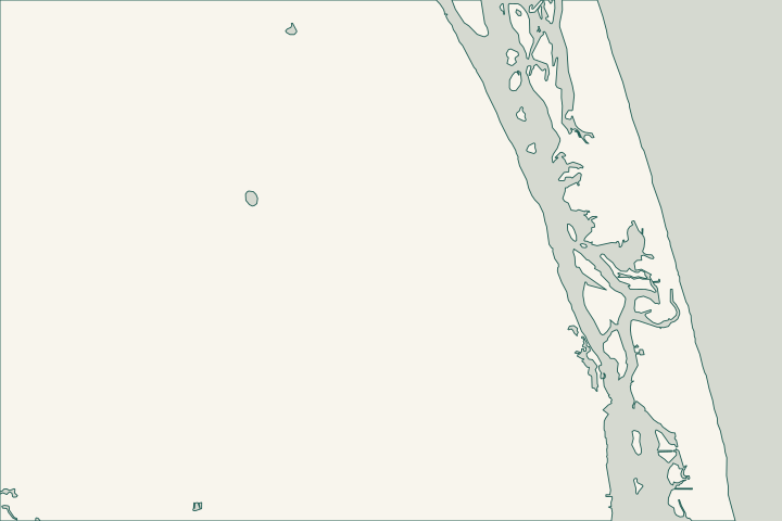
Get to know your waterfront
Gifford and Winter Beach are separate communities with related lagoon-planning questions. Gifford’s 45th Street Dock is a county waterfront landmark. Nearby Lost Tree Islands comprise roughly 508 acres of uplands, wetlands and submerged land north of the Merrill Barber Bridge, between the mainland and barrier island.
Gifford Dock / 45th Street Dock · Lost Tree Islands Conservation Area · TIGERweb Places, County Subdivisions, Consolidated Cities and Subminor Civil Divisions
A channel-edge wall needs a clear access plan
The county describes six low spoil islands in the Gifford Cut navigation channel and habitat shaped by dredging and mosquito-control impoundments. Ask the contractor to distinguish the wall footprint, proposed marine access and nearby habitat instead of treating all visible water as an unrestricted work area. Lost Tree Islands Conservation Area
Look for displaced caps, open joints and depressions in the yard, but leave the diagnosis to the assessment. Include any dock, boat lift or drainage outlet that could affect access or the repair sequence.
Winter Beach: check the conservation neighbors
A 2025 county staff report describes lagoon-adjacent mangrove impoundment and undeveloped uplands at the Winter Beach 73rd Street site. A June 2026 record approved a sale agreement for 36.99 acres there; that is not proof of completed acquisition or public access. County staff report 25-1076 — Winter Beach 73rd property Record 2026-113 — Sale Agreement for 36.99 Acre Winter Beach 73rd Street site
Indian River Land Trust also records a 2010 acquisition beside Spoonbill Marsh north of Grand Harbor. Use parcel maps to establish the boundary between a residential shoreline and neighboring conservation land. Lagoon Waterfront Initiative
For unincorporated properties, call county Building at 772-226-1260 with the address and proposed work. Building jurisdiction and contact
What could the work cost?
Require the estimate to state where machinery and materials will travel, whether marine access is assumed and who restores disturbed areas. Channel frontage, dock conflicts and conservation boundaries can change the approach. Compare written scopes before comparing a single per-foot figure.
Published planning ranges help you start a budget. Your property’s final price depends on the scope and site conditions.
Compare quotes and plan a budget →Find the relevant permits and records
| Starting point | What to resolve | Prepare and look up |
|---|---|---|
Indian River County Building Division | Local building review for unincorporated Gifford and Winter Beach parcels. | Survey, engineer-sealed drawings and separate identification of dock repairs. |
DEP Central District | Aquatic footprint, vegetation and submerged-land questions. | Existing wall position, proposed changes and nearby mangroves. |
U.S. Army Corps Cocoa Permits Section | Applicable federal review of shoreline and waterway work. | Location, dimensions and a description of proposed channel-side activity. |
Prepare for a mainland waterfront assessment
The most useful details describe the relationship between your lot and the water.
Name the frontage
Identify Gifford Cut, a residential canal or open lagoon. Add photographs showing the adjoining dock and wall ends.
Check the boundary
Compare the survey with official mapping before assuming an adjacent strip or conservation road is available for access.
County GIS resources · County staff report 25-1076 — Winter Beach 73rd property
Collect permit history
Use the county portal to locate earlier wall and dock records. Ask about missing plans rather than treating an incomplete search as proof.
Describe your Gifford or Winter Beach wall
Share the neighborhood, frontage, recent changes and any access concern near docks or conservation land.
Clear guidance for your waterfront project.
Gifford & Winter Beach project questions
Which permit office serves a Grand Harbor property?
Confirm the municipality using the parcel address and county GIS. For an unincorporated parcel, start with Indian River County Building at <a href="tel:+17722261260">772-226-1260</a>. A community name or Vero Beach mailing address does not establish the permit jurisdiction.
Can conservation land provide an easier construction route?
Do not assume so. Ownership, access permission and environmental limits must be resolved for the specific route.
Are the Gifford and Winter Beach boundaries identical?
No. Census identifies separate communities. They share this guide because their lagoon corridor has connected planning issues.
TIGERweb Places, County Subdivisions, Consolidated Cities and Subminor Civil Divisions
Keep planning
Nearby waterfront guides
Show sourcesHide sources
- Gifford Dock / 45th Street DockSource reviewed 2026-10-26
- Lost Tree Islands Conservation AreaSource reviewed 2026-10-26
- TIGERweb Places, County Subdivisions, Consolidated Cities and Subminor Civil DivisionsSource reviewed 2026-10-26
- County staff report 25-1076 — Winter Beach 73rd propertySource reviewed 2026-10-26
- Record 2026-113 — Sale Agreement for 36.99 Acre Winter Beach 73rd Street siteSource reviewed 2026-10-26
- Lagoon Waterfront InitiativeSource reviewed 2026-10-26
- Building jurisdiction and contactSource reviewed 2026-10-26
- Survey and structural drawingsSource reviewed 2026-10-26
- DEP Central District contactSource reviewed 2026-10-26
- Mangrove Frequently Asked QuestionsSource reviewed 2026-10-26 · official indexed text
- Jacksonville District Regulatory Office LocationsSource reviewed 2026-10-26 · official indexed text
- County GIS resourcesSource reviewed 2026-10-26