
Seawall repair around South Beach and The Moorings
South-island waterfronts range from residential canals to lagoon edges beside managed wetlands. A good repair proposal identifies which setting you have, how water moves around it and how equipment can reach the wall.
Describe your project on this page ↓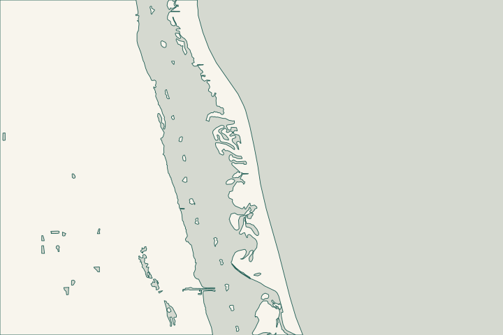
Get to know your waterfront
The county’s South Barrier Island map identifies the Moorings Club on Harbour Drive, South Beach Park on Ocean Drive and Round Island on South A1A. This is barrier-island South Beach, not mainland Vero Beach South. Confirm the parcel’s jurisdiction rather than assigning it to the city from a Vero Beach mailing address.
MPO Technical Advisory Committee packet — South Barrier Island map · TIGERweb Places, County Subdivisions, Consolidated Cities and Subminor Civil Divisions
Look beyond the wall to connected wetlands and drainage
Oyster Bar Marsh contains mangrove wetlands and a mosquito-control impoundment dating to the 1950s. Culverts connect impounded areas with the lagoon. Round Island South, west of A1A, also meets the lagoon through mangrove wetlands. These nearby landscapes make water connections and property boundaries useful assessment questions. Oyster Bar Marsh Conservation Area Round Island South Conservation Area
Ask whether the wall protects ordinary yard fill, adjoins a drainage outlet or lies near a managed impoundment. Locate any culverts before proposing fill, removal of vegetation or a changed wall alignment. Do not assume adjacent land is available for staging.
Ocean-side conditions also vary. The adopted 2026 county beach plan describes nearshore hardbottom in the South Beach sector; DEP’s historical Irma report recorded different erosion categories along nearby reaches. Neither document diagnoses today’s private wall or authorizes an oceanfront structure. Indian River County Beach Preservation Plan 2026 Update Hurricane Irma Post-Storm Beach Conditions and Coastal Impact Report
County Building is 772-226-1260. Use the official jurisdiction lookup before deciding whether Vero Beach city review is also needed. Building jurisdiction and contact Am I a City or County Resident? official lookup
What could the work cost?
Compare proposals with the same access route and restoration allowance. A canal property with restricted side access can need a different construction plan from an open lagoon frontage. Require separate treatment of wall repairs, drainage outlets, dock interference and disturbed landscaping.
Published planning ranges help you start a budget. Your property’s final price depends on the scope and site conditions.
Compare quotes and plan a budget →Find the relevant permits and records
| Starting point | What to resolve | Prepare and look up |
|---|---|---|
County Building / applicable local planning office | Establish whether the parcel is unincorporated or needs city approval. | Address lookup, survey and clearly marked waterfront work limits. |
DEP Central District | Lagoon work, submerged lands and mangrove questions. | Photos of the wall and adjoining vegetation; show any culverts or impoundment connections. |
DEP coastal construction program | Separate oceanfront beach-and-dune requirements where applicable. | Coastal mapping and the actual location of proposed structures or excavation. |
A south-island walk-through checklist
Bring these observations to the professional assessing the site.
Identify the shoreline type
State canal, open lagoon, wetland edge or Atlantic. Include the Moorings or other neighborhood name as a landmark, not a permit designation.
MPO Technical Advisory Committee packet — South Barrier Island map
Locate water connections
Mark visible pipes and culverts. Ask whether the work interacts with an impoundment or a separate drainage system.
Separate history from present condition
Use current photographs and survey measurements for the repair decision. Historical storm reports provide context only.
Hurricane Irma Post-Storm Beach Conditions and Coastal Impact Report
Share your south-island project
Include the neighborhood, waterbody, access limits and any culvert, dock or mangrove growth close to the wall.
Clear guidance for your waterfront project.
South Beach & The Moorings project questions
Is South Beach the same place as Vero Beach South?
No. South Beach is on the barrier island; Vero Beach South is a mainland Census-designated place. The distinction matters when locating the property.
TIGERweb Places, County Subdivisions, Consolidated Cities and Subminor Civil Divisions
Can a damaged wall justify clearing nearby mangroves?
Wall repairs do not automatically authorize mangrove removal. DEP advises sending details and photographs when roots or branches affect an existing wall.
Does the beach-preservation plan approve a private seawall?
No. The county adopted its regional beach-management plan on October 6, 2026. It does not itself authorize a private seawall; a proposed project needs its applicable review.
Keep planning
Nearby waterfront guides
Show sourcesHide sources
- MPO Technical Advisory Committee packet — South Barrier Island mapSource reviewed 2026-10-26
- TIGERweb Places, County Subdivisions, Consolidated Cities and Subminor Civil DivisionsSource reviewed 2026-10-26
- Oyster Bar Marsh Conservation AreaSource reviewed 2026-10-26
- Round Island South Conservation AreaSource reviewed 2026-10-26
- Indian River County Beach Preservation Plan 2026 UpdateSource reviewed 2026-10-26
- Hurricane Irma Post-Storm Beach Conditions and Coastal Impact ReportSource reviewed 2026-10-26
- Building jurisdiction and contactSource reviewed 2026-10-26
- Am I a City or County Resident? official lookupSource reviewed 2026-10-26
- Vero Beach building and planning splitSource reviewed 2026-10-26
- DEP Central District contactSource reviewed 2026-10-26
- Mangrove Frequently Asked QuestionsSource reviewed 2026-10-26 · official indexed text
- Apply for a Coastal Construction Control Line permitSource reviewed 2026-10-26 · official indexed text